The Park District's Cross Island Trail map still says the same thing at the bottom: "Total trail mileage: 4.69 miles." For years that number described the longest one-way public walk on Bainbridge Island. The route starts at Manitou, runs west through the Grand Forest and ends at Battle Point Park and the Fairy Dell Trail.
As of Oct. 1, it is the second-longest. The Bainbridge Island Review reported that the new Lost Valley Trail opened to the public that day. It finishes a route of nearly 6.8 miles from the ferry terminal to Schel Chelb beach at Lynwood Center.
The Grand Forest had its own news this season, and it points the same direction. The record went to a trail designed around walking in from town. The forest's newest land, 7.3 acres on Koura Road, is valued mostly for how neighbors could someday walk into Grand Forest North without using the road shoulder. Across the island, new trail work is about how you get to the woods.
What Took the Record
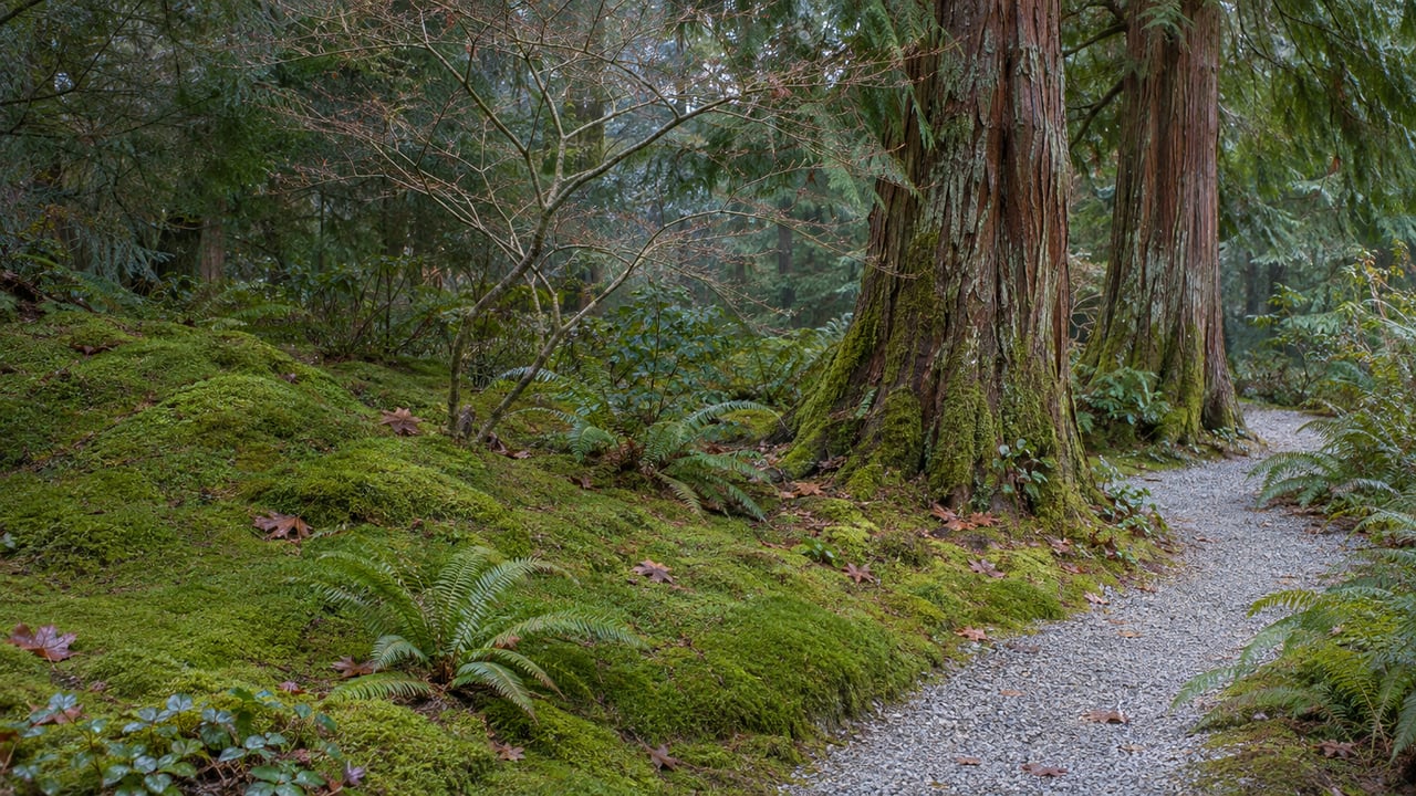
The Lost Valley Trail itself is short. It is a mostly wooded mile between the Head of the Bay and Fletcher Bay Road, crossing 40 acres of public open space, with 200 feet of boardwalk over the Cooper Creek watershed. Its length comes from what it connects. The Kojima Trail and the Vincent Road to Gazzam Lake Trail extend it west, and segments of the Charles Schmid Waterfront Trail carry it into Winslow.
The idea dates to the 1990s, when trail advocates proposed a "shore to shore" route from Winslow to Gazzam Lake Preserve. The City bought land and trail easements at the Head of the Bay in 2004. The Bainbridge Island Parks & Trails Foundation funded the final push, and the Park District's Summer Trails Crew built the boardwalk in summer 2026. At the dedication, Foundation board member Andy Maron called it "the last connection in long-sought goal of walking from Winslow to Gazzam," as the Parks & Trails Foundation recounted. Executive Director Mary Meier told the Foundation that Lost Valley "pushes us past the 50-mile mark for public trails islandwide."
One detail shapes how you use it. None of Lost Valley's four trailheads has public parking. They are at Fletcher Bay Road north of Vincent Road, the north end of Ridge Lane, Carmella Lane off Finch Road, and the lane just west of the Head of the Bay where Wyatt Way meets NE Eagle Harbor Drive. All four are reached on foot or by bicycle.
Why the Grand Forest Route Is Still the One You Can Drive To
Lost Valley assumes you will arrive on foot. The older route through the Grand Forest has parking at both ends and in the middle, so it is still the easier choice for a long winter walk that starts from a car.
| Manitou to Battle Point via Grand Forest | Ferry terminal to Schel Chelb via Lost Valley | |
|---|---|---|
| One-way length | 4.69 miles | Nearly 6.8 miles |
| Shorter version | None listed | About 5.1 miles from Rotary Park on Weaver Road |
| Parking along the way | Lots at Manitou Beach, Grand Forest West, Grand Forest East and Battle Point Park | None at any of Lost Valley's four trailheads |
Going from Manitou toward Battle Point, the Park District's Cross Island Trail map labels the route in this order:
- Manitou Beach, which has accessible parking.
- Forest to Sky, which the Park District lists with a boardwalk.
- Grand Forest West, with its trailhead at 9752 Miller Road NE, an eight-space lot and more parking on the road shoulder.
- Hilltop, the link between the West and East units.
- Grand Forest East, with its trailhead at 9594 Mandus Olson Road NE, six spaces, and a separate two-car lot on the north side about three-quarters of a mile south of Koura Road.
- The Mandus Olson Road section, running toward Battle Point Park at 11299 Arrow Point Dr NE, which has accessible parking and is the listed address for Fairy Dell.
Because there are lots at both ends and in the middle, you can walk the route in pieces. One option is a Miller Road out-and-back through Grand Forest West. Another is a Mandus Olson start that crosses Hilltop and returns. The Park District allows bikes and horses on the trail systems in both the West and East units, so expect to share the tread. Its printable maps page also has a separate Grand Forest Trails map and a Moritani Preserve map for planning shorter loops.
The East Unit Is Now Permanent
The middle of that route is more secure than it was two years ago. The 38 acres of Grand Forest East, formerly school district land, are now permanently protected. The Bainbridge Island Land Trust says island donors raised the money in two months, in a partnership between the Land Trust, the Park District and the Parks & Trails Foundation. The Park District owns the parcel and maintains its trails, with Land Trust support.
The Land Trust describes the East unit as part of a network of nearly 580 contiguous acres of conserved land. It calls the area a dense forest core that gives foraging and nesting habitat to pileated woodpeckers, great horned owls and flying squirrels. This summer the forest's next addition came on its north side.
The New Parkland Across Koura Road
In August, the Parks & Trails Foundation bought 7.3 acres of woodland on Koura Road from the Hayashida family and transferred it to the Park District as the island's newest open space park. Two private donors paid for the purchase. The Bainbridge Island Review placed the land directly across Koura Road from the northern boundary of Grand Forest North.
The parcel matters for its connections. According to the Review's account of district meeting documents, staff found the property "very suitable for a trail loop" and for possible links from Grand Forest North to the Fieldstone trail, Penny Place to Bergman Road, and Yukio Lane. Trails could eventually reach as far north as Bay Hill Road. The Review also reported that the land offers more than 600 feet of north-south walking away from the edge of Miller Road, and a way for trail users to reach Grand Forest North without walking the Koura Road shoulders.
The parcel would add to a connection already in place. The Koura-Yukio Trail, completed in 2022, runs between Koura Road and Yukio Lane, and the Foundation describes it as a shortcut to the Grand Forest.
The land also has history. Interpretive signs planned for the park, which does not have a name yet, will tell the story of Japanese American farming in the Koura Road area. The Hayashidas and other Japanese American families owned land there and grew strawberries through the mid-20th century, in what is now the Meadowmeer neighborhood. Protective covenants limit the property to passive uses and nonmotorized trails. Park District Executive Director Dan Hamlin described the district's plans in its August announcement:
"We look forward to working with the community this fall to shape trails that honor this history while giving islanders a beautiful new place to connect with nature."
For now the parcel is not a destination. The Park District has said there are no trails on the property and no public access, and it has asked the public to respect the neighbors and the habitat until trails are built. The district plans to talk with neighbors before trail work starts and to hold a public celebration later. The parcel fronts both Koura and Miller roads and wraps around a developed lot at their intersection, so the boundary on the ground is less obvious than it looks on a map.
Two Walks on the Winter Calendar
The Land Trust has two dates listed for the weeks ahead. Both entries say more details are coming, so check the Land Trust events page before you go.
- Guided Walk: Grand Forest, Friday, Nov. 27, the day after Thanksgiving. It is listed as an all-day event.
- Solstice Night Woods Walk, Monday, Dec. 21, at Hilltop, the high point between the forest's West and East units.
Lost Valley now holds the record for the island's longest one-way walk. At 4.69 miles, the Manitou-to-Battle Point route through the Grand Forest is the long walk with parking lots along the way. And the parcel across Koura Road, with no trails yet, is where the Grand Forest's next connection to the surrounding neighborhoods is likely to start.
At The Agency Bainbridge Island, we follow how the island's open spaces take shape, from the new parkland on Koura Road to the new boardwalk at the Head of the Bay, because each new trail connection changes how a home relates to the woods nearby. If you'd like to know which properties sit closest to the Grand Forest trail network and its planned links, we'd be glad to walk you through the map. Schedule a private consultation.